North to the Yukon, Day 10 – Heading Home

Today was a pleasant, uneventful last day in mountain country.  We left Prince George, BC at 8 this morning, and cut back across British Columbia and Alberta, completing our northern loop.

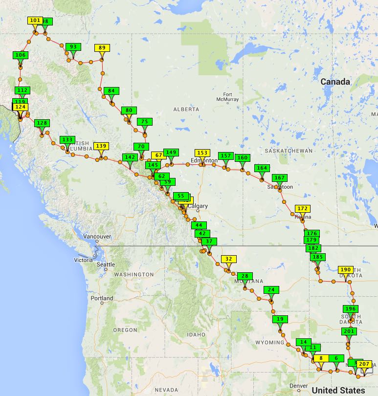
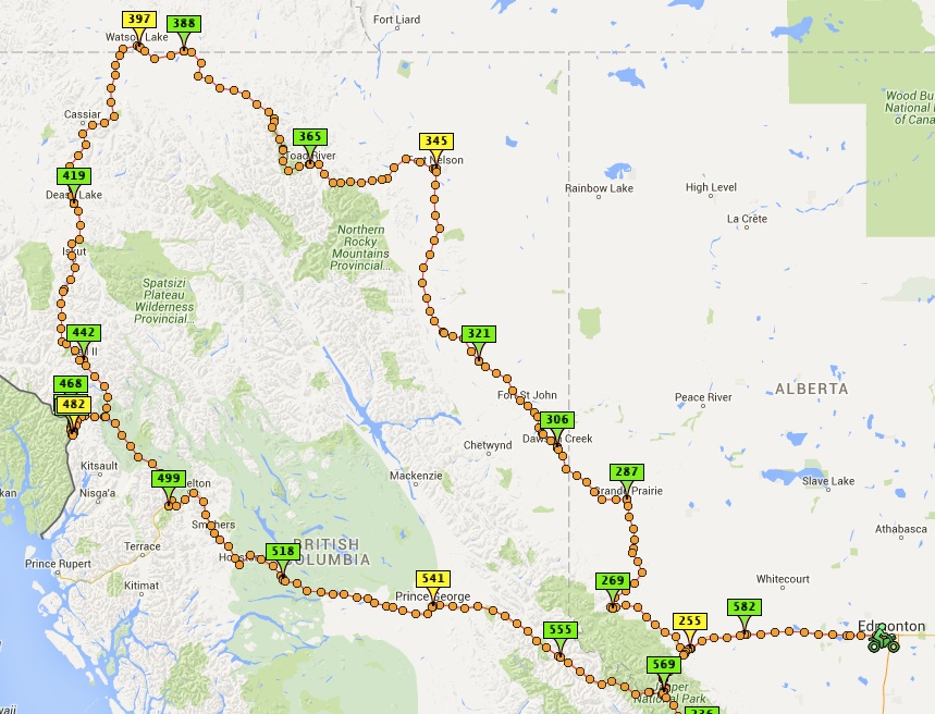
The Spotwalla satellite track of our loop through northwest Canada and southern Alaska.

The Spotwalla satellite track of our loop through northwest Canada and southern Alaska.

If you squint when you look at the little map, you can see that we followed a mountain valley back to Jasper, then cut across the middle of the park, and then continued on to the city of Edmonton.

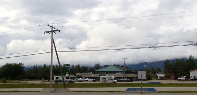
Low clouds, rain showers, and a damp chill followed us much of the way, but that’s what we’ve come to expect.

low clouds from a gas stop.

Low clouds from a gas stop.

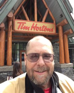
RalphatTHWe stopped for lunch at Tim Horton’s at the town of Jasper.  We’d had dinner in Jasper on our way north last week. So nice to have a fast food place with good soup and croissants for lunch!  If only the biggest fast food chain in the US would serve that.  And honey crullers!

We saw a giant super cell thunderstorm off in the distance, and saw a big enough flash of lightening that both Howard and I remarked on it over dinner tonight.  Fortunately, though we continued to go through scattered showers, we did not have to deal with storms. Once we left Jasper and the nearby town of Hinton  (outside of which we saw both bighorn sheep and a giant elk!) we were clearly back into the central plains of North America, and I’m afraid it will be the prairie for the rest of the trip.

By the time we reached Edmonton, the skies had cleared and it was almost hot out.

Let me finish up this decidedly unphilosophical post by giving a shout-out to Howard’s sister, Susannah.  She very generously gave us Marriott points to pay for our hotels anytime we were able to find a Marriott property.  Up north, they were decidedly not available.  But tonight we are in a comfortable Courtyard hotel, and I will soon go down to take advantage of the whirlpool.

Thank you, Susannah!


Posted in Motorcycling, Travel | Tagged , , , | Comments Off on North to the Yukon, Day 10 – Heading Home

North to the Yukon, Day 9 – It’s a mountaintop, not a bucket list

The bikes are ready and waiting in the damp morning to start heading south and east toward home.

The bikes are ready and waiting in the damp morning to start heading south and east toward home.

Howard and I have now completed Day One of the long haul back home to Nebraska and Texas. Today’s ride was excellent – we even saw some moose, and tomorrow’s ride takes us back through Jasper National Park. But there can be no denying that we are headed back toward the end of vacation and the return to the routine of regular life.

It’s popular to call big trips like this “bucket list” items – that is, things you want to do before you “kick the bucket.”

I hate that expression for a host of reasons:

  • It implies that you have to hurry up and do lots of things before you die.
  • It implies that you can do things once, check them off your list, and be done with them.  Like they are a responsibility.
  • It implies that for many things, doing them once is all you need to do.

For me, I much prefer the term “mountaintop experience.” That captures the idea that something is special, maybe even unique. But not that you can’t go back there.  And it says that it is a big part of living, not a preparation for death.

This trip to the Yukon, southern Alaska, and the Canadian (and American) Rockies has been both a literal and figurative mountaintop experience. The literal part is pretty easy – we’ve been up, down, around and over mountains almost constantly for the last week. But it’s also been a metaphorical mountaintop as well. It’s been a chance to soak in the beauty of the world; to see how small so many things are when compared to things that are so big; to be able see, hear, feel and smell things at a level we don’t normally get to.  And it’s been a chance to go to places most people only dream of going because it’s just too far to go.

The most important reason for this not being a bucket list trip, however, is because this isn’t something I’m checking off.  It will be something that stays with me for a long time to come.  I still think about a backpacking trip I took with my older brother more than 35 years ago. It’s still with me. And I hope that I haven’t left these beautiful areas behind forever.  I want to come back to see the mainland of Alaska, and Canada’s Northwest Territories, and…. It’s not a check box, it’s an introduction.

So, no, this has not been a bucket list vacation for me.  But I have certainly been to the mountaintop.

Posted in Motorcycling, Travel | Tagged , , , | 1 Comment

North to the Yukon, Day 8 – ALASKA!

All along, I’ve billed this as a trip to the Canadian Rockies more than a trip to Alaska. But today we really did go to the southernmost part of Alaska accessible by road.  It’s a good deal south of the Yukon where made our northernmost turn around – more than 400 miles south and west of Watson Lake, YT.

We’ve been staying two nights in Stewart, British Columbia, which is just across the border from Hyder – our only two-night stay of the trip.  So reasonably bright and early this morning, we headed over the border into Hyder.  There’s no border control/customs for entering the US there, apparently because there is no place to go other than Hyder and the Salmon River Glacier once you get there.  The road to Hyder literally doesn’t go anywhere else.

Welcome to Hyder, Alaska.

Welcome to Hyder, Alaska.

We had plans to visit three places in Alaska (in Alaska!). The first of these was the Fish Creek Wildlife Viewing Area – That’s another name for the local Bears and Eagles All-You-Can-Eat Salmon Buffet. While the board walk for humans and streams for animals and fish were all beautiful, the salmon had yet to arrive, so we saw none of the top-level predators about.

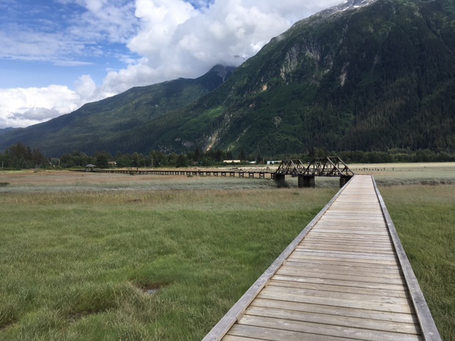
The boardwalk for viewing the bears at the Fish Creek Wildlife Viewing Area.

The boardwalk for viewing the bears at the Fish Creek Wildlife Viewing Area.

As the salmon hadn't arrived yet, we saw neither bears nor eagles,but it was still beautiful.

As the salmon hadn’t arrived yet, we saw neither bears nor eagles,but it was still beautiful.

From there, we headed up the road to see our second destination in Alaska – the Salmon River Glacier.  This is about 35 kilometers of fairly good dirt road rising from near sea level up to more than 3,000 feet.

This was the view through my windshield on the way up the road to the Salmon River Glacier viewing areas.

This was the view through my windshield on the way up the road to the Salmon River Glacier viewing areas.

Here's the Salmon River itself.

Here’s the Salmon River itself.

I'm not certain, but I believe from the sequence on my camera that this should be the thumb of the glacier. Our first really good view of this impressive river of ice.

I’m not certain, but I believe from the sequence on my camera that this should be the thumb of the glacier. Our first really good view of this impressive river of ice.

We knew when we set out this morning that there was a good chance we wouldn’t get to see much at the top with the clouds hanging low over the mountains. And the view into the valley didn’t give us a lot of hope.

While the clouds in the valley as we headed up the mountain were dramatic, they made us wonder if there would be anything to see at the top.

While the clouds in the valley as we headed up the mountain were dramatic, they made us wonder if there would be anything to see at the top.

When we finally reach the top, dealing with huge amounts of dust, work trucks going to install high tension electrical wires in the area beyond the overlook, and a generally rocky, bumpy road, this is what we see:

Where's the giant glacier?  It's hiding there in the clouds.  We knew when we set out this morning that there was a good chance we wouldn't get to see much at the top with the clouds hanging low over the mountains.

Where’s the giant glacier? It’s hiding there in the clouds. 

But then…

But then the clouds would clear for a few seconds giving us a peek at this field of ice, and then, just as quickly, the clouds would close back in.  Then a bit later, they would open up again for another peek.  You had to be attentive, but if you were, the rewards were great.

But then the clouds would clear for a few seconds giving us a peek at this field of ice, and then, just as quickly, the clouds would close back in. A bit later, they would open up again for another peek. You had to be attentive, but if you were, there was an amazing view.

On the ride down, my comfort level with riding on dirt roads continued to grow, though I confess a certain level of nervousness the first few kilometers riding on the valley side of the road rather than the mountain side.

When we reach the pavement, Howard and I scoot past the Bear Salmon Buffet, and headed over to the Seafood Express Bus, our third destination.

This is the legendary Seafood Express Bus serving fresh caught local seafood.

This is the legendary Seafood Express Bus serving fresh caught local seafood.

SeafoodExpressSignThis is a long-standing Hyder institution that is on every motorcyclist’s list of places to visit when they get to Hyder.  It’s run by a family where the husband and son are commercial fishermen, and wife/mom runs the bus as sort of non-moving food truck. There actually is a bit of indoor seating to be had, along with a clean restroom featuring a purple toilet.

But the real pleasure is to sit outside and talk with your fellow travelers while dining on smoked salmon spread served with soda crackers (absolutely amazing!), fish sandwiches, or halibut and chips, among other items.

It’s not a place to go if you are in a hurry. As the bus rules state:

  1. NO WORRY
  2. NO HURRY
  3. RELAX
  4. ENJOY!

Given the tiny kitchen, mom can only cook one or two meals at a time. So relax, don’t worry, talk to the other folks at your table, and have some great food in an unbelievable setting.  Howard and I had lunch with a group of Harley riders up from Corpus Christie, Texas and had fun conversation along with our fish.

From there, it was back to the Portland Canal that is a fjord that goes all the way out to the Pacific Ocean, and is Canada’s northernmost ice-free port.

It's not hard to imagine getting on a boat and heading out to the Pacific Ocean from here.  The breeze there even feels like it's coming from the sea.

It’s not hard to imagine getting on a boat and heading out to the Pacific Ocean from here. The breeze there even feels like it’s coming from the sea.

Then it’s back to the Canadian border where the pleasant, but emphatic border agents make sure you are not planning any misbehavior during your visit to the land of the maple leaf flag. (We actually crossed back into Canada on the road to the glacier overlook, but while there was a sign noting the border, there’s no official crossing.  What are you going to do? Pull out a paraglider and fly on into the country?)

And with that, Howard and I are back in Stewart, BC, getting our bikes fueled up and ready to be packed in the morning for the long, long ride home.

We still have some beautiful roads to ride, we still have some national parks to visit, and we still have to ride through my grandfather’s homestead in northwest North Dakota, but the biggest part of our adventure has come to a close.

We’ve been North to the Yukon and South to Alaska, and now we head south and east back toward Nebraska and Texas, which is still more than 2,300 miles for me, and close to 3,200 for Howard.

But don’t worry, there will still be blog posts over the days to come, so don’t go away.

Posted in Travel | Tagged , , , | Comments Off on North to the Yukon, Day 8 – ALASKA!

North to the Yukon, Day 7 – Pictures from a Trip

Getting started.

Getting started.

Pictures from a Trip by Tim Rumsey is one of my favorite novels – it’s a bittersweet story about two brothers who spend a summer dinosaur hunting in Wyoming. And anytime I look at photos from a trip, I think about that book.

Today’s entry is a collection of pictures from my trip, along with just a little text from Howard’s and my time following much of the British Columbia Great Northern Circle Route – taking the Alaska Highway from Dawson Creek, BC, up to Watson Lake, Yukon Territory, and then taking the Stewart-Cassiar  Highway back south.  We then split off that route to go spend a full day at Stewart, BC and Hyder, Alaska.

So without further ado, lets get started.

I believe I've mentioned that it has rained almost everyday on this trip.  I'm not sure which of the three days on the loop this was, but could be any of them.

I believe I’ve mentioned that it has rained almost everyday on this trip. I’m not sure which of the three days on the loop this was, but could be any of them.

We had a great lunch of soup and homemade bread after a chilly and wet morning of riding on our second day on the Alaska Highway. Travelers, the Toad River Lodge is your friend.

We had a great lunch of soup and homemade bread after a chilly and wet morning of riding on our second day on the Alaska Highway. Travelers, the Toad River Lodge is your friend.

We met Alex from France mid-afternoon as we were on our way to Watson Lake, YT. He was spending five months traveling around the US and Canada, trying to see as much as possible. On this day, he was riding with Paul from Australia (not pictured).  Always fun to talk with other travelers, especially those on long journeys.

We met Alex from France mid-afternoon as we were on our way to Watson Lake, YT. He was spending five months traveling around the US and Canada, trying to see as much as possible. On this day, he was riding with Paul from Australia (not pictured). Always fun to talk with other travelers, especially those on long journeys.

Road construction has been a consistent fact of life on this trip, and here Howard and I are waiting for the pilot car to lead is through a particularly messy section of road work.  Any time we've had a pilot car, all the motorcyclists have been waived to the front of the line.

Road construction has been a consistent fact of life on this trip, and here Howard and I are waiting for the pilot car to lead is through a particularly messy section of road work. Any time we’ve had a pilot car, all the motorcyclists have been waived to the front of the line.

We've seen lots of animals, including buffalo...

We’ve seen lots of animals, including buffalo… (Photo by Howard Koontz)

And several bears, though we don't have photos of many of them.  Stopping to take pictures of bears is not the smartest thing to do on a motorcycle.

And several bears, though we don’t have photos of many of them. Stopping to take pictures of bears is not the smartest thing to do on a motorcycle. (Photo by Howard Koontz)

After two days of going mostly north on the Alaska Highway, we were ready to head south to Alaska on the Stewart-Cassiar Highway.

After two days of going mostly north on the Alaska Highway, we were ready to head south to Alaska on the Stewart-Cassiar Highway.

Dease Lake, if I'm not mistaken.  One of many gorgeous lakes along the way.

Dease Lake, if I’m not mistaken. One of many gorgeous lakes along the way.

And finally, the view from Stewart, British Columbia, which will be our base for the next day. This is the only place on the trip where we spend two nights in the same place.

And finally, the view from Stewart, British Columbia, which will be our base for the next day. This is the only place on the trip where we spend two nights in the same place.

Posted in Motorcycling, Travel | Tagged , , , | Comments Off on North to the Yukon, Day 7 – Pictures from a Trip

North to the Yukon, Day 6 – We Arrive

For the last week, more or less, Howard and I have been headed north and west for more than 2,500 miles. And today we arrived at our northernmost destination – Watson Lake, Yukon Territory.

Our bikes at the Welcome to Yukon sign.

Our bikes at the Welcome to Yukon sign.

If you look at the trace left by my SPOT satellite tracker, you can see just how far we’e gone (and Howard’s gone close to a thousand miles further):

Our trip so far.

Our trip so far.

So, you might ask, why is the Yukon a territory and not a province?  Because while it is somewhat bigger than California, it only has about 35,000 people in it – That’s like a town roughly the size of Kearney with all the university students on campus.

Watson Lake feels like the remote place that it is.  There are two places you can get hot food in town – Kathy’s Cafe and the truck stop. Everything is rustic.  The hotel we are staying in tonight is a recommissioned World War II air corp barracks.  It’s clean and comfortable (and pretty cheap by local standards), but the bathrooms and showers are down the hall from your room, reminding you that it really did use to be a bunk house.

Howard and I spent a fair amount of time at the main tourist attraction for Watson Lake – The Signpost Forest.  This is a collection of thousands of signs posted by visitors since the first one was put up by a lonely Army man who was missing home as he worked on the Alaska Highway back in 1942. Our host at the Air Force Lodge, Mike, describes the forest as “the world’s largest collection of stolen property” – which has some truth to it, but is not the whole story.  There are many stolen street and city signs, but far more that people have made by hand so that they can leave a lasting memento of their visit.

The Sign Forest is an almost endless collection of signs dating back to 1942.

The Sign Forest is an almost endless collection of signs dating back to 1942.

Of course, just because we have made it to the Yukon does not mean we are ready to head home yet.  In the morning we head south toward our westernmost destination – Stewart, British Columbia and Hyder, Alaska.  So in the morning we leave the Alaska Highway and head south on the Stewart-Cassiar Highway. Yes, at this point we are headed south to Alaska. To be fair, we are not going up to the mainland Alaska; instead, we are headed to the little spit of Alaska that extends hundreds of miles down the Canadian coastline.

But that’s a story for another day.

Posted in Motorcycling, Travel | Tagged , , , | Comments Off on North to the Yukon, Day 6 – We Arrive

North to the Yukon, Day 5 – Dawson Creek and the Alaska Highway Milepost Zero

Updated

I woke up at 4 this morning, which would be 6 a.m. back home and my usual wake-up time.  I took a look out the window, and it was clearly getting light out, though I don’t think it ever really got dark last night. We’re really up north now.

4 am out my hotel window in Dawson Creek

4 am out my hotel window in Dawson Creek

Another bit of evidence? While my phone apps still have weather data and forecasts up here, we’re now past the area where there is weather radar coverage.  Even the Canadian weather page online doesn’t provide weather radar this far north.

Dawson Creek looks like you are on the frontier, but it is still a pretty town.

There’s a nice looking art gallery and interesting public art.

DCArtGallery

Gallery and visitors center near the Milepost Zero sign.


LampPostDC

Fun decorations on some of the lamp posts.

There are actually two Milepost Zero markers in town for the Alaska Highway – the one that’s actually at the site of the original Milepost Zero, and another one a block or two away more in the downtown area.  No, I don’t understand, either.


AlaskaHighwayMonument

The “other” Milepost Zero.

And here’s the one everyone takes their picture in front of, including us!

Howard and Ralph at the Milepost Zero in Dawson Creek.

Howard and Ralph at the Milepost Zero in Dawson Creek.

The Alaska Highway was built following the attack on Pearl Harbor as the United States decided it needed a better way to connect Alaska to the mainland.

The history of Dawson Creek and the Alaska Highway.

The history of Dawson Creek and the Alaska Highway.

Today it has lots of truck traffic headed north, along with a lot of tourists, many on motorcycles – Like us!  But as for now, we are on our way north!

Posted in Motorcycling, Travel | Tagged , , , | Comments Off on North to the Yukon, Day 5 – Dawson Creek and the Alaska Highway Milepost Zero

North to the Yukon, Day 4 – Getting the bikes dirty

View From The Dirt

View from the Smith Dorrien Trail (aka Route 742).

Today was Day 4 of our trip, in which we rode from Hinton, Alberta, just outside of Jasper National Park, to Dawson Creek, British Columbia.  While it was a lovely ride, it was really a traveling day where the goal was to get to the next destination – namely the start of the Alaska Highway, which happens to be in Dawson Creek.

So instead of telling you about the pleasant roads and the kilometer after kilometer of pine forests and natural gas wells, I’m going to go back to the start of Day 3 to tell you about our morning’s ride.

For those of you who not as familiar with motorcycles, Howard and I are riding motorcycles that are classified as adventure bikes.  They are basically bikes built for touring, but with some ability to, if not go off road, at least run well on dirt roads.  Howard’s KTM (the orange bike) has more off-road ability than my softer-focused Yamaha.  These are both big, heavy bikes that weigh in the vicinity of 600 pounds.

But as many of these adventure bikes that are out there, a good percentage of them never make it off the pavement.  Howard is a devoted dual-sport rider (that is, on and off road riding), and has a smaller, more dirt-oriented bike as well. And he was determined we should get our bikes dirty.

Route 742 off of Alberta 40 south of the Trans-Canada Highway near Banff

Route 742 off of Alberta 40 south of the Trans Canada Highway near Banff.

The night before as we were looking over online maps, Howard picked up that we had passed an interesting road 30 or so kilometers back that followed a winding path over the mountains up to Canmore, AB near the Trans Canada Highway, our initial waypoint for Day 3 on our way to Banff and Jasper national parks. So we decided to check out Route 742.  We headed back south on Alberta 40, then stopped to fill up our tanks.  (One of the rules of riding in remote areas is never pass a known gas stop in hopes of finding an unknown one!) The manager of the gas station said the scenery on the route was gorgeous, but that the road was gravel/dirt and could be pretty rough.  But then he looked out at our bikes and said, “But you’ve got the bikes to handle it.”

Now you should know that while Howard is an experienced dirt road rider, I am not.  I’ve always had street-oriented tires on my bike in past that always get kind of squirrelly when you throw gravel, sand or mud at them. But before this trip, Howard and I both put K60 Scouts on our bikes – tires that are equally at home in the dirt and on pavement. (i.e. – They are 50-50 street-dirt tires.) My bike also has some electronic riding aides that help with making the bike handle better under low-traction situations.

HowardOnDirtRoad

Howard in front of me on the Smith Dorrien Trail (aka Route 742)

So we ride up to the road (also known as the Smith Dorrien Trail), and it’s starting to rain. But I figure, I’ve got the right bike and tires for this, and I’ve got an experienced dirt rider with me.  No time like the present.  It took a few kilometers, but I gradually got used to the feel of the bike on the washboarded gravel road.  The new tires were great – I had so much more control on the gravel than I had had with my more street oriented tires.

As I rode, my comfort level went up, and I was soon able to ride the relatively low speed limit on the road.  Eventually, I even dialed back the electronic help one notch to better match the conditions.

At the end of the road, we had done about 89 kilometers worth of dirt/gravel road over a mountain pass in the Rockies, and I had found a whole new way of enjoying motorcycling.

Before I start feeling too proud, however, when we came near the end of the road, where there were lots of people parked to go hiking, Howard noticed there was a Smart Car in the lot.  Now, while the Smart Car didn’t go the whole route, it was still there…)

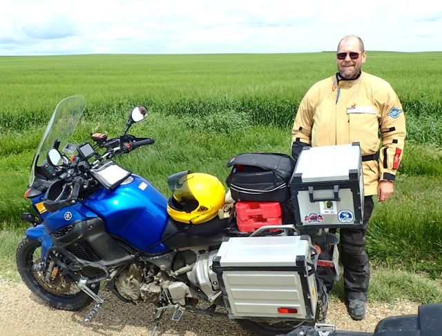
Howard with his KTM Adventurer and my Yamaha Super Teneré

Howard with his orange KTM Adventurer and my blue Yamaha Super Teneré

Posted in Motorcycling, Travel | Tagged , , , | Comments Off on North to the Yukon, Day 4 – Getting the bikes dirty

North to the Yukon, Day 3 – Weather With You

Riding in the Rain

Photo by Howard Koontz

“Everywhere you go, you always take the weather, take the weather with you.”
-Neil Finn

There’s always the assumption that if you don’t have perfect weather on a motorcycle trip, something’s wrong. But I would have to say that an adventure is what happens when everything isn’t perfect.

Two by two, hands of blue...For most of our trip so far (and we are now at the finish of day three), we have had wind, rain, cold and damp in various measures each of the days. While we could have done without some of the wind, the rest have all been just part of the adventure.  We’ve always managed to get stopped in time to close up the vents and get the rain gear on. Of course, not all our gear is glamorous.  We rough, tough bikers use giant bus boy rubber gloves over our regular gloves to keep the rain at bay.

Sometimes the the clouds and cold bring something more than sun and blue skies with puffy clouds could.  The gloom of the clouds seems to fit the harsh lines of the Rockies.

I've looked at clouds from both sides now.

We have, of course, had plenty of warm, sunny times as well.  And those times are wonderful. But just because it’s raining doesn’t mean there’s anything wrong.


Posted in Motorcycling, Travel | Tagged , , , | Comments Off on North to the Yukon, Day 3 – Weather With You

North to the Yukon, Day 2 – Going to Glacier

After a 760-mile day, it was nice to have one a bit shorter, even though there was still lots of time in the saddle.

We got a reasonably early start out of Great Falls, Montana. Glacier National Park was beautiful on Monday morning, if a bit crowded. What can you expect on Fourth of July at one of the major parks… (As a side note, I’m really sorry I didn’t get any photos of the people lining up for a Fourth of July parade in small town Montana.) But even with the crowds it was still really gorgeous and fun. Howard has never been to Rockies before.

Me with my bike near the summit of Logan Pass.

Me with my bike near the summit of Logan Pass.

Howard with his bike. It was cool up there!

Howard with his bike. It was cool up there!

Then we took back roads up to the Canadian border crossing. Very quiet station! Asked how long we would be there, where we were going, and did we have any weapons. Easy Peasy.

We then rode across some really flat open plains and then turned toward the mountains again after having late lunch at Tim Horton’s. Ride toward the mountains was beautiful, but the temperature kept getting colder and colder, and there were deep purple clouds over the mountains – it was obviously raining. We stopped, got closed up for rain, and I plugged in my jacket… And we had a beautiful ride through the mountains. Cold! Dropped down into the low 40s. And while the pavement was wet enough that we both were kicking up spray, there was no rain.

Storm clouds over the road through the mountains.

Storm clouds over the road through the mountains. (Photo by Howard Koontz)

So we got off easy.

Tomorrow we’re going up to Banff and Jasper, and riding the Icefield Parkway. Going to just take it easy tomorrow – only about 200 miles to go. Will spend time being tourists.

Posted in Motorcycling, Travel | Tagged , , , | Comments Off on North to the Yukon, Day 2 – Going to Glacier

North to the Yukon, Day 1 – The Longest Day

So just a note on the numbering of days. I have an itinerary with the days numbered, that start once Howard and I start riding together. So that makes this post Day 1.  The day we met up in Sidney is Day 0, and the day I prepared to leave was Day -1.

We had a good, long day of traveling Sunday. Had to cover a lot of miles (760 of them) so we would have more time up north. But we still didn’t let that keep us from collecting national parks stamps from Scotts Bluff National Monument, Fort Laramie National Historic Site, and the Little Bighorn National Battlefield.

As I’ve mentioned before, people who think Nebraska is flat and boring have never been to the northwest part of the state.  When you get to Scotts Bluff you really get a feeling that you are in the Old West.

Ralph and Howard at Scotts Bluff National Monument.

Ralph and Howard at Scotts Bluff National Monument.

From there, it was on to Wyoming and Fort Laramie.  It’s a late 19th century fort with the buildings made of an early form of limestone concrete.  Historically interesting and important, if not nostalgic.

An early concrete bunkhouse from Fort Laramie.

An early concrete bunkhouse from Fort Laramie.

Overall, the riding was good, but we hit some weather around Little Bighorn National Battlefield, near the southern Montana border. We saw the weather ahead and pulled under a bridge to close up the vents, put the rain covers over bags, and get ready for the wet. We had to give the Little Bighorn short shrift given that we were trying to get ahead of the weather. We weren’t entirely successful, but but managed to miss much of the rain, if not the wind.

The cemetery at Little Bighorn National Battlefield is a dramatic lesson in a dramatic setting. Storm clouds were approaching and pushed us on our way.

The cemetery at Little Bighorn National Battlefield is a dramatic lesson in a dramatic setting. Storm clouds were approaching and pushed us on our way.

So far this has not been a gourmet trip. We got into Great Falls, Montana late enough that all the restaurants were closed, so we had to scavenge what we could from a convenience store for dinner.

Up Next: Going to Glacier, Going to the Sun, going to Canada.

Posted in Motorcycling, Travel | Tagged , , , | 1 Comment